


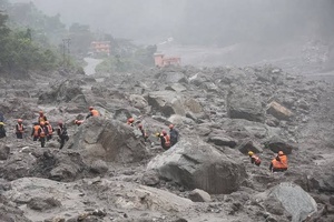
Three months before a catastrophic flood tore through communities along the Nepal-China border, Nepali officials had already identified a problem that would become painfully relevant: the countries needed a more effective system for sharing information about rapidly developing hazards in the high Himalayas. At a meeting in Kathmandu on May 27, officials discussed cooperation on floods, weather, glaciers and other mountain risks, including better inventories of glacial lakes and hazard mapping. Nepal wanted more than general weather forecasts. Its officials were seeking earlier information about glacier movement, avalanches, water levels and other indicators that could give downstream communities more time to react.
The August disaster did not prove that this information gap caused the loss of life. The available evidence points instead to a more complicated vulnerability. The flood was triggered by a sudden glacier collapse in a remote and relatively poorly monitored area, producing an exceptionally rapid chain of events. Yet the catastrophe also demonstrated why conventional flood-warning arrangements may no longer be sufficient for Himalayan communities whose risks increasingly originate high above the river channels they inhabit.
China maintains significantly greater technical and financial capacity for monitoring large parts of the Tibetan plateau, while Nepal depends on information from upstream areas it cannot easily observe itself. That geographical reality makes cooperation essential. But cooperation is not the same as a fully integrated warning system, and the events of August exposed the consequences of that distinction.
A warning system that sees weather better than cascading hazards
China did provide Nepal with information before the disaster. Twelve days before the flood, Chinese meteorological authorities warned of enhanced rainfall and the possibility of secondary hazards, including landslides and flash floods. Chinese officials have also maintained that information was shared in a timely manner. The issue, therefore, is not simply whether warnings crossed the border. It is what kind of information was available, how quickly it could be interpreted, and whether it could identify the specific chain of events that eventually unfolded.
That distinction is critical. A rainfall forecast can indicate heightened flood risk without identifying that a glacier or unstable mass of ice and rock is about to collapse. Likewise, information about river levels may become useful only after an event has already begun. For a community downstream from an unstable mountain slope, the most valuable warning could be the detection of an upstream physical change before the river itself rises dramatically.
Nepali officials said they had received forecasts and observations concerning heavy precipitation but had sought more information on avalanches, water levels and extreme events. The gap was therefore partly one of hazard coverage. A modern Himalayan warning system has to connect meteorological forecasting with glacier surveillance, seismic monitoring, remote sensing, river gauges and rapid communication to communities. Without that integration, individual pieces of information may exist without producing an actionable warning.
The broader regional picture reinforces this problem. Research and disaster-management initiatives in the Hindu Kush Himalayas have repeatedly identified the need for transboundary monitoring and early-warning systems because rivers and hazards do not respect national borders. Existing bilateral arrangements can help, but regional experts have also argued that they are not sufficient for hazards operating across multiple countries and river basins.
The minutes between detection and destruction matter
The August catastrophe also exposed another weakness: even when a disaster is detected, warning systems may have only a very short period in which to protect people.
According to the account of Nepali officials, the flood struck a border area at around 8:32 a.m. A Nepali official was alerted roughly 26 minutes later, while monitoring stations stopped transmitting data. Downstream equipment also became unavailable, apparently because infrastructure was destroyed or overwhelmed. Nepal subsequently issued a public alert at around 9:13 a.m.
Those timings demonstrate why the debate cannot be reduced to whether one country should have issued a warning earlier. In a rapidly cascading mountain disaster, every stage matters: detection, confirmation, transmission, interpretation, decision-making and public communication. A warning that arrives after a monitoring station has been destroyed may still be valuable for communities farther downstream, but it cannot protect people who are only minutes from the initial impact.
This is particularly important because the flood was not a conventional rainfall-driven event. Preliminary assessments described a glacier collapse that released a high-speed mass of water, mud and rock. The resulting torrent travelled downstream with enormous destructive force, damaging bridges, roads and energy infrastructure.
The challenge is therefore technological as well as institutional. Monitoring equipment must survive extreme conditions and continue transmitting information when other infrastructure fails. Warning systems also need redundancy. If a single border station disappears, satellite observations, seismic instruments, upstream sensors and neighbouring monitoring networks should be capable of filling the information gap.
Recent work in the region shows that such technology is becoming more feasible. Cross-border research teams have been installing monitoring stations and collecting data in the Nepal-China border area, while researchers have been working toward future warning platforms. The existence of these initiatives suggests that the scientific problem is not beyond reach. The harder question is whether the information generated by separate systems can be connected quickly enough to become a common operational warning mechanism.
Climate change is making old assumptions less reliable
The urgency comes from the changing physical environment of the Himalayas. Glaciers are retreating and changing in ways that can destabilise slopes, alter meltwater patterns and increase the potential for glacial lake and debris-related disasters. The Hindu Kush Himalayas contain an enormous concentration of glaciers and provide water to some of the world's most densely populated downstream regions. As temperatures rise, hazards that were once considered rare or geographically isolated can become increasingly important to disaster planning.
But climate change should not become a convenient explanation for every failure. The August disaster cannot simply be attributed to warming temperatures and treated as unavoidable. Nor can every information-sharing problem be portrayed as evidence of deliberate withholding. The available evidence does not support either conclusion.
What it does show is that existing systems face a growing mismatch between the complexity of mountain hazards and the institutional arrangements designed to monitor them. A system built primarily around rainfall forecasts is poorly equipped for a disaster in which glacier instability, rockfall, temporary blockage, sudden water release and downstream flooding interact within minutes.
That is why Nepal's request for more frequent information is significant. Officials have discussed seeking data at intervals as short as 10 minutes, alongside stronger cooperation on monitoring avalanches and glacial-lake water releases. Such an arrangement would not eliminate risk, but it could reduce the period during which authorities are effectively blind to developments upstream.
The problem is also larger than Nepal and China. India, Bangladesh, Bhutan, Nepal, China and other Himalayan countries share interconnected river systems and mountain hazards. A major event in one country can rapidly become a humanitarian or infrastructure emergency in another. Regional mechanisms for interoperable data, common warning standards and coordinated response therefore have a practical value that extends beyond diplomatic cooperation.
The central lesson from the disaster is consequently not that an early warning was simply missing. It is that the definition of an early warning is changing. In an increasingly unstable Himalayan environment, warning cannot begin only when rainfall intensifies or a river starts rising. It must begin with continuous observation of the mountains themselves.
Nepal's experience shows why that requires trust, technical capacity and institutional agreements across borders. China has capabilities that Nepal cannot easily reproduce across the Tibetan frontier, while Nepal possesses downstream knowledge essential for understanding how an upstream event translates into danger for populated valleys. Neither side can build a comprehensive warning system alone.
The catastrophe has therefore turned a technical request made months earlier into a much larger policy question: whether the countries sharing the Himalayas can move from exchanging selected forecasts to operating a genuinely integrated system capable of detecting, interpreting and communicating fast-moving mountain hazards before they become disasters.
(Source:www.internazionale.it)
The August disaster did not prove that this information gap caused the loss of life. The available evidence points instead to a more complicated vulnerability. The flood was triggered by a sudden glacier collapse in a remote and relatively poorly monitored area, producing an exceptionally rapid chain of events. Yet the catastrophe also demonstrated why conventional flood-warning arrangements may no longer be sufficient for Himalayan communities whose risks increasingly originate high above the river channels they inhabit.
China maintains significantly greater technical and financial capacity for monitoring large parts of the Tibetan plateau, while Nepal depends on information from upstream areas it cannot easily observe itself. That geographical reality makes cooperation essential. But cooperation is not the same as a fully integrated warning system, and the events of August exposed the consequences of that distinction.
A warning system that sees weather better than cascading hazards
China did provide Nepal with information before the disaster. Twelve days before the flood, Chinese meteorological authorities warned of enhanced rainfall and the possibility of secondary hazards, including landslides and flash floods. Chinese officials have also maintained that information was shared in a timely manner. The issue, therefore, is not simply whether warnings crossed the border. It is what kind of information was available, how quickly it could be interpreted, and whether it could identify the specific chain of events that eventually unfolded.
That distinction is critical. A rainfall forecast can indicate heightened flood risk without identifying that a glacier or unstable mass of ice and rock is about to collapse. Likewise, information about river levels may become useful only after an event has already begun. For a community downstream from an unstable mountain slope, the most valuable warning could be the detection of an upstream physical change before the river itself rises dramatically.
Nepali officials said they had received forecasts and observations concerning heavy precipitation but had sought more information on avalanches, water levels and extreme events. The gap was therefore partly one of hazard coverage. A modern Himalayan warning system has to connect meteorological forecasting with glacier surveillance, seismic monitoring, remote sensing, river gauges and rapid communication to communities. Without that integration, individual pieces of information may exist without producing an actionable warning.
The broader regional picture reinforces this problem. Research and disaster-management initiatives in the Hindu Kush Himalayas have repeatedly identified the need for transboundary monitoring and early-warning systems because rivers and hazards do not respect national borders. Existing bilateral arrangements can help, but regional experts have also argued that they are not sufficient for hazards operating across multiple countries and river basins.
The minutes between detection and destruction matter
The August catastrophe also exposed another weakness: even when a disaster is detected, warning systems may have only a very short period in which to protect people.
According to the account of Nepali officials, the flood struck a border area at around 8:32 a.m. A Nepali official was alerted roughly 26 minutes later, while monitoring stations stopped transmitting data. Downstream equipment also became unavailable, apparently because infrastructure was destroyed or overwhelmed. Nepal subsequently issued a public alert at around 9:13 a.m.
Those timings demonstrate why the debate cannot be reduced to whether one country should have issued a warning earlier. In a rapidly cascading mountain disaster, every stage matters: detection, confirmation, transmission, interpretation, decision-making and public communication. A warning that arrives after a monitoring station has been destroyed may still be valuable for communities farther downstream, but it cannot protect people who are only minutes from the initial impact.
This is particularly important because the flood was not a conventional rainfall-driven event. Preliminary assessments described a glacier collapse that released a high-speed mass of water, mud and rock. The resulting torrent travelled downstream with enormous destructive force, damaging bridges, roads and energy infrastructure.
The challenge is therefore technological as well as institutional. Monitoring equipment must survive extreme conditions and continue transmitting information when other infrastructure fails. Warning systems also need redundancy. If a single border station disappears, satellite observations, seismic instruments, upstream sensors and neighbouring monitoring networks should be capable of filling the information gap.
Recent work in the region shows that such technology is becoming more feasible. Cross-border research teams have been installing monitoring stations and collecting data in the Nepal-China border area, while researchers have been working toward future warning platforms. The existence of these initiatives suggests that the scientific problem is not beyond reach. The harder question is whether the information generated by separate systems can be connected quickly enough to become a common operational warning mechanism.
Climate change is making old assumptions less reliable
The urgency comes from the changing physical environment of the Himalayas. Glaciers are retreating and changing in ways that can destabilise slopes, alter meltwater patterns and increase the potential for glacial lake and debris-related disasters. The Hindu Kush Himalayas contain an enormous concentration of glaciers and provide water to some of the world's most densely populated downstream regions. As temperatures rise, hazards that were once considered rare or geographically isolated can become increasingly important to disaster planning.
But climate change should not become a convenient explanation for every failure. The August disaster cannot simply be attributed to warming temperatures and treated as unavoidable. Nor can every information-sharing problem be portrayed as evidence of deliberate withholding. The available evidence does not support either conclusion.
What it does show is that existing systems face a growing mismatch between the complexity of mountain hazards and the institutional arrangements designed to monitor them. A system built primarily around rainfall forecasts is poorly equipped for a disaster in which glacier instability, rockfall, temporary blockage, sudden water release and downstream flooding interact within minutes.
That is why Nepal's request for more frequent information is significant. Officials have discussed seeking data at intervals as short as 10 minutes, alongside stronger cooperation on monitoring avalanches and glacial-lake water releases. Such an arrangement would not eliminate risk, but it could reduce the period during which authorities are effectively blind to developments upstream.
The problem is also larger than Nepal and China. India, Bangladesh, Bhutan, Nepal, China and other Himalayan countries share interconnected river systems and mountain hazards. A major event in one country can rapidly become a humanitarian or infrastructure emergency in another. Regional mechanisms for interoperable data, common warning standards and coordinated response therefore have a practical value that extends beyond diplomatic cooperation.
The central lesson from the disaster is consequently not that an early warning was simply missing. It is that the definition of an early warning is changing. In an increasingly unstable Himalayan environment, warning cannot begin only when rainfall intensifies or a river starts rising. It must begin with continuous observation of the mountains themselves.
Nepal's experience shows why that requires trust, technical capacity and institutional agreements across borders. China has capabilities that Nepal cannot easily reproduce across the Tibetan frontier, while Nepal possesses downstream knowledge essential for understanding how an upstream event translates into danger for populated valleys. Neither side can build a comprehensive warning system alone.
The catastrophe has therefore turned a technical request made months earlier into a much larger policy question: whether the countries sharing the Himalayas can move from exchanging selected forecasts to operating a genuinely integrated system capable of detecting, interpreting and communicating fast-moving mountain hazards before they become disasters.
(Source:www.internazionale.it)
